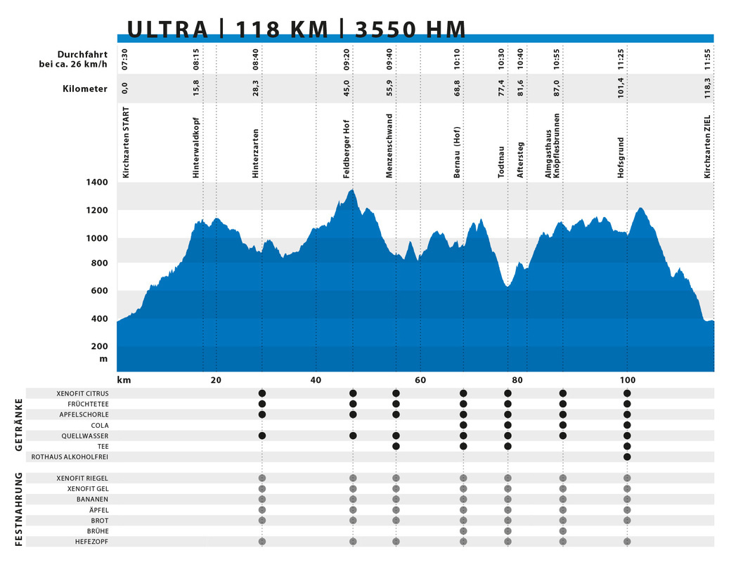
ULTRA | 118 km | 3.509 elevation meters
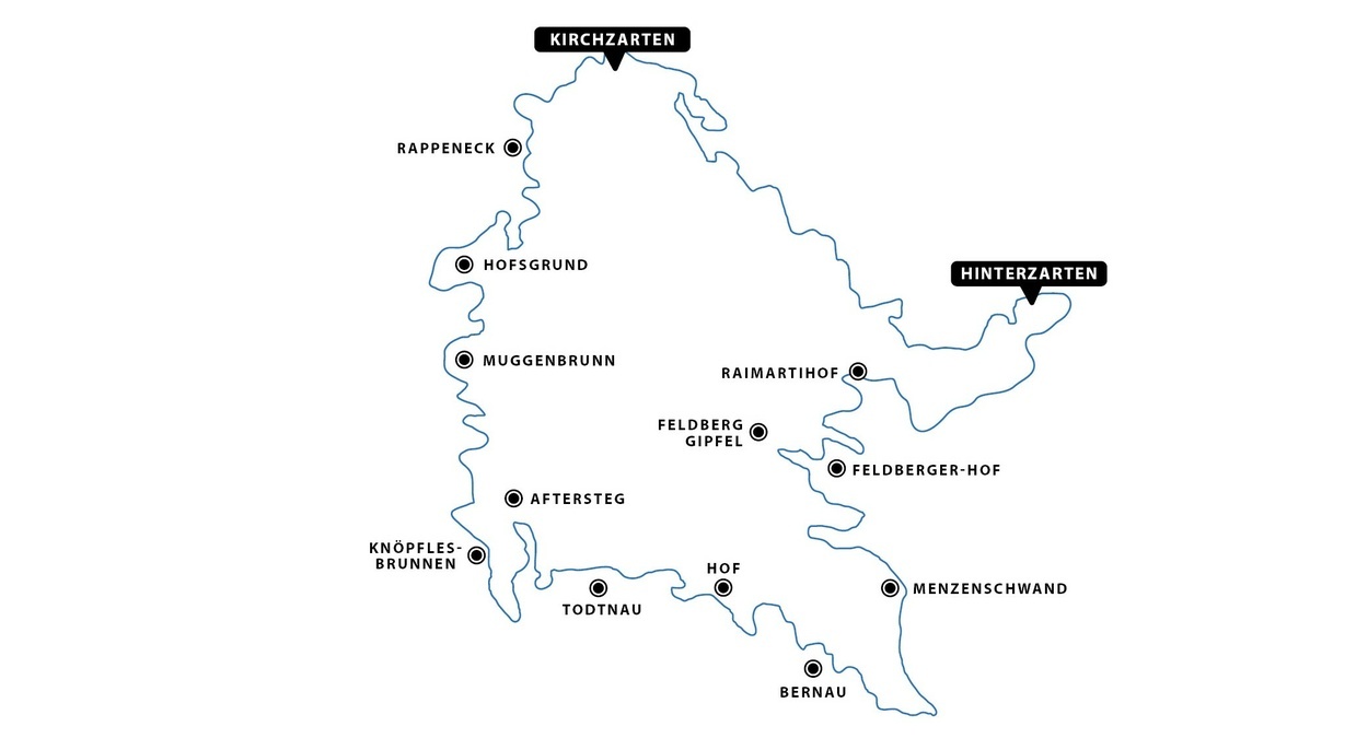
No mercy for the calves: With 118 km and 3,509 meters of elevation gain, this year's ULTRA is even more "ultra"! The starting shot for the flagship event of the Black Forest ULTRA Bike Marathon is in the pedestrian zone in Kirchzarten. Amidst the applause of numerous spectators, everyone with sporting ambitions heads out of Kirchzarten, traversing forest paths and trails to Hinterwaldkopfsattel. There, you can briefly enjoy the wonderful view of the Dreisamtal valley before continuing to Hinterzarten via many smaller, beautiful forest paths to Adlerschanze.
By Adlerschanze, you've covered about a quarter of your daily stage and can replenish your energy at the refreshment point. It's needed here because afterward, there's a steep ascent out of Hinterzarten, over Bruderhalde, on many beautiful, diverse paths to Raimartihof. At Raimartihof, the routes diverge for ULTRA, Marathon, and Short Track.
After a challenging climb, you reach Feldberg Seebuck. Yes, you heard it right - you're cycling over the highest mountain in the Black Forest! At Seebuck, there's another refreshment point. Shortly after, you reach the highest point of the route at 1,375 meters above sea level, where you should definitely take a brief moment to pause and enjoy the breathtaking view of the Wiesental valley! Afterward, it's action-packed as you cross the B 317 mountain pass road via the ski bridge. Further downhill, you head to Menzenschwand Hinterdorf, where you return to the old, familiar route. At the former ski jump, you can quickly stock up on drinks and bars.
From Menzenschwand Vorderdorf, you navigate through forest and meadow paths, narrow, rocky trails towards Kaiserberg. Shortly before, you will have reached half of the race distance. Another refreshment point awaits you in Bernau Hof. Once your reserves are replenished, you make your way past the Prägbach Waterfall up to the Bernauer-Kreuz-Weg. From there, you descend to Todtnau, where, in front of the magnificent St. Johannes Church in the center of Todtnau, you meet the route of the Speed Track and find a refreshment point.
Back in the saddle, you head towards Todtnau-Feriendorf and further to Aftersteg. Finally, the legendary and well-deserved Alpe de Fidlebrugg awaits you. On the extremely challenging ascent with a 20% gradient, Thomas Zipfel, along with his party guests, will boost your energy as you conquer the mountain! If you think you've made it, there's another uphill stretch to Almgasthaus Knöpflesbrunnen, where the next refreshment point awaits. The beautiful mountain range allows you occasional glimpses into the Wiesental until you eventually arrive in Muggenbrunn Oberhäuser. There, you have covered about three-quarters of the route.
Through the enchanted Trubelsbach, you head towards Notschrei, to Haldenköpfle, across Schauinslandstraße to Hofsgrund. Here, you reach the 100 km mark! On a meadow path, you descend to the refreshment point at Hofsgrund Ortsmitte. Subsequently, another challenging ascent awaits you to Schauinsland, where you reach another "high point" at 1,239 meters above sea level. The last 15 kilometers take you into the forest towards Rappenecker Hütte, descending to Oberried. Along the way, you encounter the Marathon route again. Via Dietenbach and the campground in Kirchzarten, you eventually reach the finish line in the stadium.
Elevation profile
Hot spots
# Hinterzarten
# Feldberg-Seebuck
# Menzenschwand
# Bernau
# Todtnau
# Aftersteg / „Alp de Fidlebrugg“
# Hofsgrund
# Schauinsland
# Feldberg-Seebuck
# Menzenschwand
# Bernau
# Todtnau
# Aftersteg / „Alp de Fidlebrugg“
# Hofsgrund
# Schauinsland
Refreshment points
| Verpflegungsstelle | UTM-Koordinaten (WGS84) | Dezimalgrad (WGS84) |
| Hinterzarten | 32T 433487 5305594 | 47.900229°, 8.110067° |
| Feldberg | 32T 427901 5301423 | 47.86210°, 8.03603° |
| Menzenschwand | 32T 430323 5297368 | 47.825891°, 8.069072° |
| Bernau, Hofecklift | 32T 426120 5296927 | 47.821446°, 8.012992° |
| Todtnau | 32T 421178 5298036 | 47.830841°, 7.946779° |
| Knöpflesbrunnen | 32T 418811 5297500 | 47.825727°, 7.915257° |
| Hofsgrund | 32T 417540 5305861 | 47.900773°, 7.896685° |


